
 A cold and breezy Wenesday is in store for the Greater Red Bank Green, with highs in the mid-to-upper 20s and wind chill readings in the single digits, according to the National Weather Service.
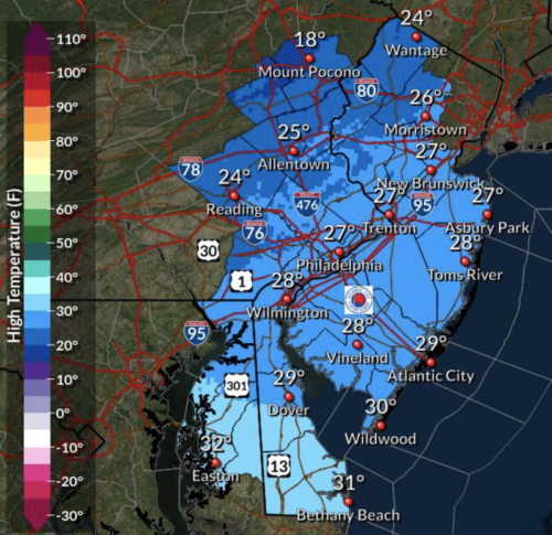
Check out the extended forecast below. (NWS image. Click to enlarge.)Wednesday
A slight chance of snow showers after noon. Mostly sunny, with a high near 27. Breezy, with a west wind 15 to 20 mph. Chance of precipitation is 20%.
Wednesday night
Partly cloudy, with a low around 18. West wind 8 to 15 mph.
Thursday
Partly sunny, with a high near 33. West wind 8 to 14 mph, with gusts as high as 26 mph.
Thursday night
Partly cloudy, with a low around 25. West wind 5 to 10 mph becoming light northwest after midnight.
Friday
A slight chance of snow after 10am, mixing with rain after 1pm. Mostly cloudy, with a high near 36. Calm wind becoming south 5 to 7 mph in the afternoon. Chance of precipitation is 20%.
Friday night
A chance of rain and snow before 10pm, then a chance of snow between 10pm and 1am. Mostly cloudy, with a low around 31. Chance of precipitation is 30%. New precipitation amounts of less than a tenth of an inch possible.
Saturday
Mostly sunny, with a high near 43.
Saturday night
A chance of rain after 1am. Mostly cloudy, with a low around 34. Chance of precipitation is 40%.
Sunday
Rain. High near 50. Chance of precipitation is 90%.
Sunday night
A chance of rain before 1am. Mostly cloudy, with a low around 39. Chance of precipitation is 40%.
Monday
Mostly sunny, with a high near 48.
Monday night
Partly cloudy, with a low around 33.
Tuesday
Sunny, with a high near 43.


