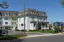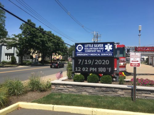
 The temperature reading at the Little Silver firehouse was in triple digits at noontime Sunday.
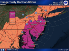
Regional heat index values for the day topped out at 104 degrees, according to the National Weather Service.
‘Feels like’ temperatures are expected to soar to 105 degrees Monday, with the heat wave easing Tuesday. Check out the extended forecast below. (Photo by John T. Ward. Click to enlarge.)
Monday
A slight chance of showers and thunderstorms after 2pm. Partly sunny, with a high near 96. Heat index values as high as 105. West wind 5 to 10 mph. Chance of precipitation is 20%.
Monday Night
Partly cloudy, with a low around 75. Northwest wind 5 to 10 mph.
Tuesday
Mostly sunny, with a high near 89. North wind around 5 mph becoming south in the afternoon.
Tuesday Night
A slight chance of showers and thunderstorms after 2am. Mostly cloudy, with a low around 74. South wind around 5 mph becoming calm. Chance of precipitation is 20%.
Wednesday
Showers and thunderstorms likely, mainly after 2pm. Mostly cloudy, with a high near 88. Chance of precipitation is 60%. New rainfall amounts of less than a tenth of an inch, except higher amounts possible in thunderstorms.
Wednesday Night
Showers and thunderstorms likely, mainly before 8pm. Mostly cloudy, with a low around 75. Chance of precipitation is 60%.
Thursday
A chance of showers and thunderstorms after 2pm. Partly sunny, with a high near 90. Chance of precipitation is 30%.
Thursday Night
A chance of showers and thunderstorms before 8pm. Partly cloudy, with a low around 72. Chance of precipitation is 30%.
Friday
Mostly sunny, with a high near 85.
Friday Night
Partly cloudy, with a low around 71.
Saturday
Mostly sunny, with a high near 85.
Saturday Night
Partly cloudy, with a low around 71.
Sunday
Partly sunny, with a high near 87.