
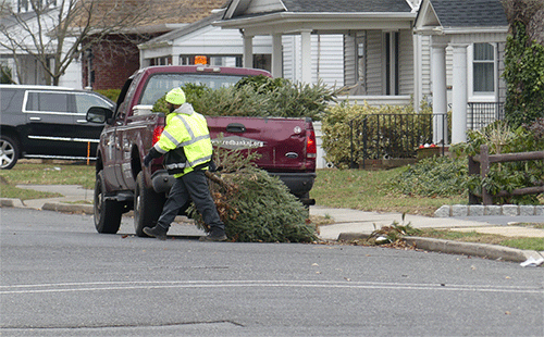
 Putting the X in Xmas, a Red Bank DPU worker collects Christmas trees along Madison Avenue last week.
Up next: Dr. Martin Luther King Jr. Day on Monday. Will the Greater Green see snow for the occasion? The National Weather Service says a “significant winter storm” could impact the region this weekend, though details are uncertain this far in advance.
Meantime, it just feels like… winter, of all things. Check out the forecast below. (Gif by Trish Russoniello. Click to enlarge.)
Tuesday
Sunny, with a high near 37. Northwest wind around 6 mph.
Tuesday Night
Mostly clear, with a low around 27. West wind around 7 mph.
Wednesday
Mostly sunny, with a high near 39. West wind 13 to 15 mph.
Wednesday Night
Mostly clear, with a low around 25. West wind 10 to 13 mph becoming north after midnight.
Thursday
Partly sunny, with a high near 34. North wind 5 to 9 mph becoming light and variable.
Thursday Night
Snow likely before 4am, then rain and snow. Low around 31. Chance of precipitation is 80%. New precipitation amounts between a tenth and quarter of an inch possible.
Friday
Rain and snow showers before 7am, then a chance of rain showers between 7am and 10am. High near 45. Chance of precipitation is 80%.
Friday Night
Partly cloudy, with a low around 30.
Saturday
A chance of rain after 1pm. Mostly cloudy, with a high near 39. Chance of precipitation is 40%.
Saturday Night
Rain. Low around 33. Chance of precipitation is 80%.
Sunday
Rain, snow, and sleet likely. Cloudy, with a high near 41. Chance of precipitation is 70%.
Sunday Night
Snow and sleet likely. Mostly cloudy, with a low around 15. Chance of precipitation is 60%.
M.L.King Day
Mostly sunny, with a high near 26.


